Silicon Valley startup Planet had 60 Earth-imaging cubesats (pictured) in orbit by October, when it won a $20 million contract to provide daily 3-5-m-resolution (10-16-ft.) imagery to the National Geospatial Intelligence Agency, having deployed 145 from the International Space Station (ISS) since 2013. Google-owned Terra Bella has seven sub-1-m-resolution SkySats in orbit, with 10 more to follow. BlackSky launched its first 1-m-resolution satellite in September, with 50 planned. And Hera Systems has nine 1-m-resolution 1HOPSats to launch by early 2017, with its first 22-cm-resolution 2HOPSats to follow by year-end.
Forecasting Weather
Credit: GeoOptics
Startups GeoOptics and Spire Global have won National Oceanic and Atmospheric Administration contracts to provide weather data using GPS radio occultation—measuring the bending of signals as they traverse the Earth’s atmosphere. Spire has launched 12 Clyde Space-built Lemur-2 cubesats, with more than 50 planned. GeoOptics hoped to launch the first of six Cicero satellites (pictured) in 2016. PlanetIQ plans to launch the first 12 of 18 similar satellites in 2017, built by Blue Canyon Technologies
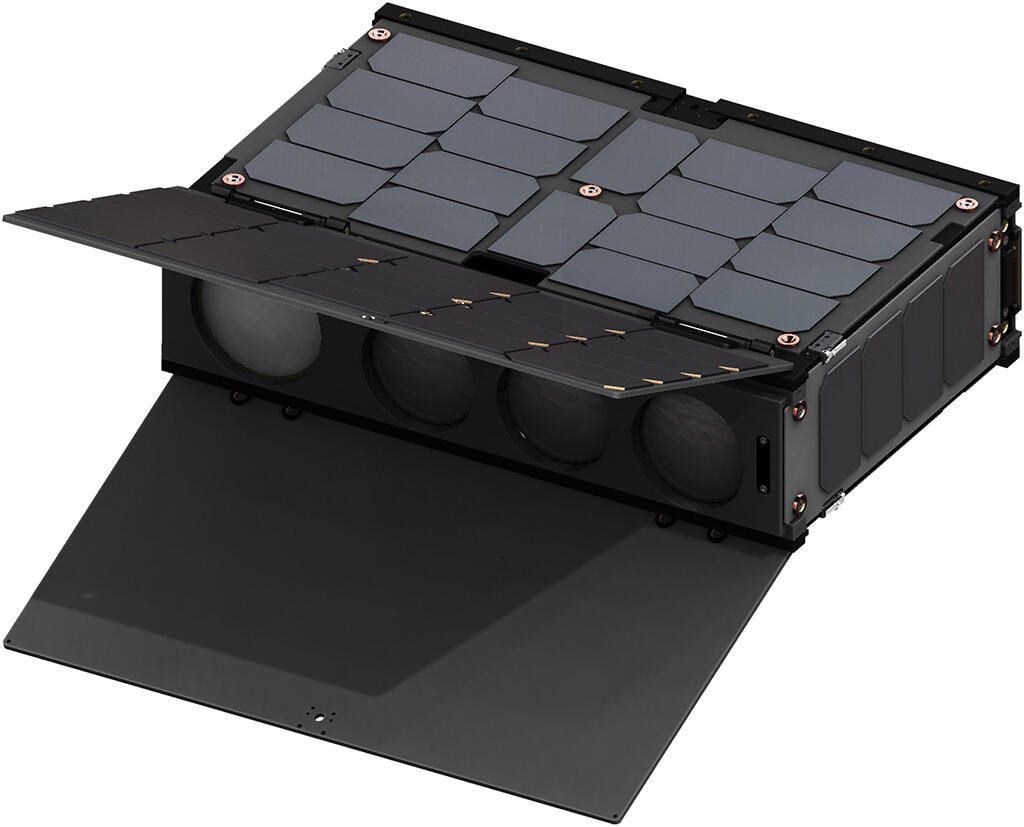
Radar Imaging
Credit: Urthecast
The first integrated optical and radar-imaging constellation is planned by Canada’s Urthecast. OptiSAR would comprise eight tandem pairs of multispectral and dual-band radar satellites (pictured). Based on Surrey Satellite Technology’s NovaSAR, OptiSAR would provide 0.5-m optical, 1-m X- and 5-m L-band imaging.
Mapping Signals
Credit: Deep Space Industries
Late in 2017, Hawkeye 360 plans to launch the first three satellites that will identify, locate and analyze radio-frequency transmissions to track transport networks, pinpoint spectrum interference and unused bandwidth and assist in emergencies. Deep Space Industries is building the initial microsat cluster.
Earth Science
Credit: NASA
NASA’s eight-cubesat Cygnss mission aims to improve hurricane forecasting by measuring ocean surface roughness and calculating wind speeds using the scattering of GPS signals by waves. Launch is planned by mid-December 2016.
Managing Land
Credit: Astro Digital
Multispectral sensors have shrunk to smallsat size. Astro Digital and Aquila Space Technology plan a constellation of 30 Landmapper satellites matching Landsat’s spectral properties. First launch is set for 2016. Satellogic of Argentina’s constellation of 25 hyperspectral NuSats is to be launched starting in the second quarter of 2017. Planetary Resources plans 10 Ceres hyperspectral satellites covering 40 color bands.
Mining Asteroids
Credit: Planetary Resources
Planetary Resources launched its first Arkyd space telescope (pictured), in 2015 to demonstrate near-Earth asteroid detection, ahead of a commercial asteroid mining mission expected in 2020. Rival Deep Space Industries plans a Prospector-X mission to test its technology in low-Earth orbit ahead of the Prospector-I asteroid mission.
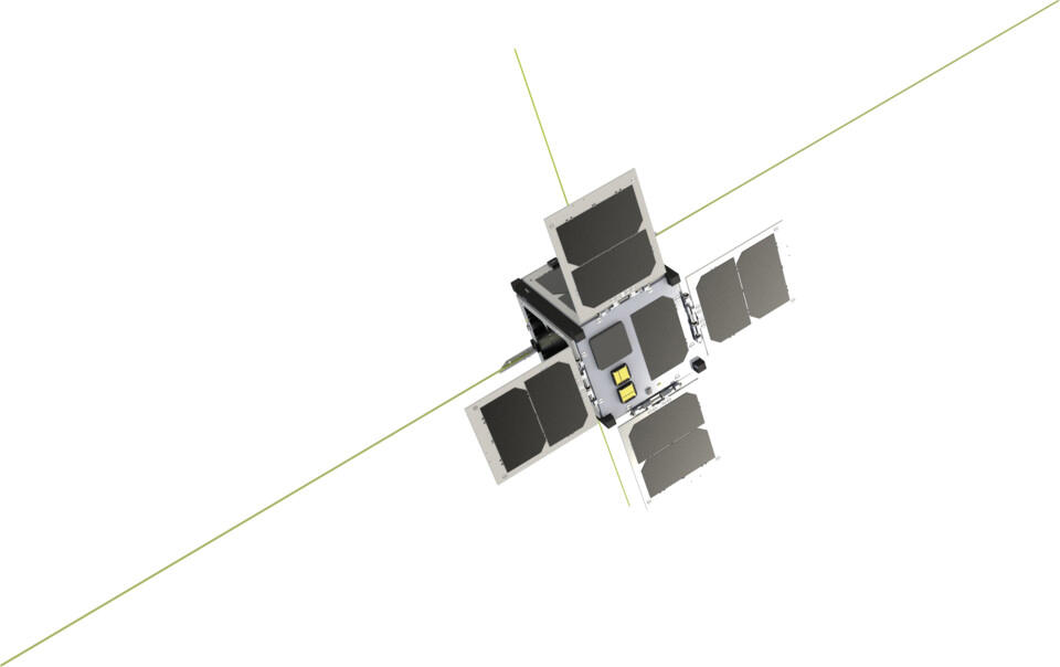
Space Internet
Credit: Clyde Space
Headlines have been grabbed by plans for broadband LEO constellations comprising 720 smallsats for OneWeb and 4,425 for SpaceX. But satellite internet has many forms. Clyde Space has built three cubesats (pictured), for Outernet, which broadcasts web news and weather, crop prices and medical advice free to inexpensive receivers worldwide. Launch will be on the first Rocket Labs’ Electron. Canada’s Kepler Communications plans to orbit 50 cubesats beginning in late 2017 to provide Internet of Things connectivity.
Virtual Reality
Credit: SpaceVR
A more unusual cubesat venture is SpaceVR, which has built the first virtual-reality camera satellite. To be launched to the International Space Station in June 2017, Overview1 has attitude controls, reaction wheels and two cameras to live-stream a 360-deg. view from space to VR headsets.
Advances in commercial electronics are making it possible for satellites as small as cubesats to perform missions once reserved for large, costly spacecraft.