Business aviation aircraft operate into a wide spectrum of airports that sometimes can lack credible sources of information regarding runway conditions.
Snowy runways, low ceilings and a crosswind landing are threats that a prudent flight crew will take seriously. Now add a runway distance that is barely marginal if the subjective braking action reports are “good,” and the situation turns into one in which every decision and action by the flight crew needs to be “spot on.”
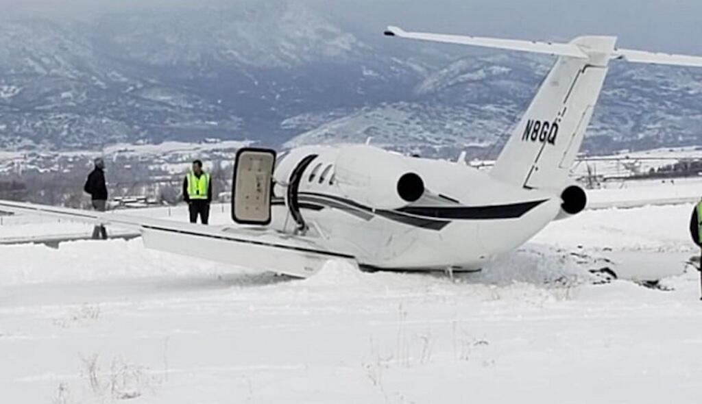
To further heighten the risk, let’s put a body of water at the boundaries of the marginal length runway. That was the situation faced by the flight crew of Delta Flight 1086, a McDonnell Douglas MD-88, as it approached New York’s LaGuardia airport (LGA) on the snowy day of March 5, 2015.
The flight left Atlanta that morning for the flight to LGA. While en route the flight crew continued to monitor the weather conditions at LGA and assessed the factors that could affect stopping performance. They closely examined company policies for landing on contaminated runways and understood that a change in runway conditions from accumulating snowfall could increase the landing distance and that a change in wind could cause the flight to exceed crosswind limits.
The flight crew asked the dispatcher and the Washington Air Route Traffic Control Center controller for braking action reports, but neither had any reports at the time because LGA operations personnel were conducting snow removal operations and no aircraft were landing. The four previous ATIS reports (issued between 07:51 and 10:24) contained outdated and contradictory field condition information about the status of LGA’s runways. Besides company and ATIS reports, ATC communications as late as 10:40 gave the impression to the flight crew that at least some patches of runway surface would be visible upon breaking out of the IMC on the approach.
But upon first seeing the runway in sight at 233 ft. AGL, the runway appeared white. This was contrary to their expectations given the recent snow cleaning operations and the reports of good braking action by two of the four preceding aircraft. Only 13 seconds elapsed between the time the captain called the runway in sight and the 50 ft. automated call-out, during which the flight crew intensely focused on precise control of the aircraft. It would have been difficult for the crew to visually assess the nature and depth of the snow on the runway.
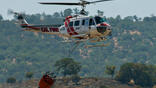
A combination of factors resulted in the MD-88 veering off the runway, coming to rest with the nose of the aircraft over the berm above Flushing Bay. There were no fatalities, but 24 people were injured.
While the bulk of the official NTSB accident report focused on a phenomenon called rudder blanking, the accident amply illustrates the consequences when the actual runway environment differs from the reported conditions. Accurately predicting the effects of wind, temperature and runway surface conditions are vital to every takeoff and landing. Standard practice in the aviation industry expects a pilot to dutifully enter the performance charts for these parameters to calculate the aircraft’s performance. Yet there are many reasons why the actual runway environmental conditions can vary significantly from the reported values.
The situation is amplified for business aviation aircraft that operate into a wide spectrum of airports, most of which are non-towered and have limited resources for runway snow removal. The runways often do not include features such as crowning, grooves and porous filled concrete to minimize the pooling of water that exist on runways serving scheduled air carriers.
FBO personnel likely have little training on the accurate assessment of braking action from the perspective of an aircraft’s needs. Furthermore, transitory phenomena such as the melting action from daytime sun on snowbanks adjacent to a runway can result in a liquid that turns into black ice after sunset and will not be readily apparent.
Winds At The Threshold
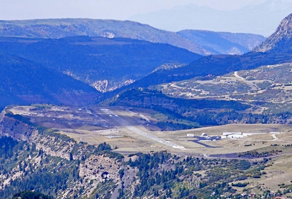
Some of business aviation’s most glamorous locations are surrounded by significant landscape that creates its own micro-climate. Notable domestic U.S. examples are Aspen, Eagle, Telluride, Gunnison, Sun Valley, Truckee, and Jackson. European examples include Gstaad, Samedan (St. Moritz) and Courchevel. These are considered some of the most challenging airports in the world because of their difficult topography, winds, and high altitude.
The micro-climate effects produce rapidly changing localized winds that won’t be detected by an airport’s AWOS. Adverse winds caused by mountain wave, diurnal “canyon” winds or convective activity can create downdrafts of significant strength.
Localized winds just short of the landing threshold can cause negative effects on an aircraft’s stability, control, and performance. Even minor variations in vertical currents as the aircraft is precariously transitioning into the landing flare can cause the aircraft to balloon or dive markedly from the desired glide path. A sudden loss of headwind from windshear can cause the aircraft to nose down and temporarily lose important airspeed.
These effects can be even more pronounced when a runway’s threshold is close to vertical terrain. A classic example would be the cliff adjacent to the threshold of Telluride’s Runway 9. As the sun’s angle moves across the sky and begins to heat that slanted terrain, the air immediately adjacent to the cliff begins to heat and rises rapidly in a thermal.
For those without the benefit of a soaring background, thermals are rising parcels of air that continue to rise as long as the surrounding air is cooler. It is not uncommon for the strength of the cores of these thermals to exceed 2,000 fpm in the western states. Conversely, the outer portion of these rising bubbles (imagine the shape of a doughnut, with the middle rising and the outside descending) can be nearly as strong.
Aircraft control and flight path maintenance can instantly be compromised by these sudden and surprisingly strong vertical air currents. Incidentally, there is a warning for pilots that the Telluride airport sits on a 1,000-ft. mesa, with the precaution of strong vertical turbulence along the mesa’s edge.
The wind environment close to the approach end of the runway can change rapidly, we explain in Part 2 of this article.

Related Content